
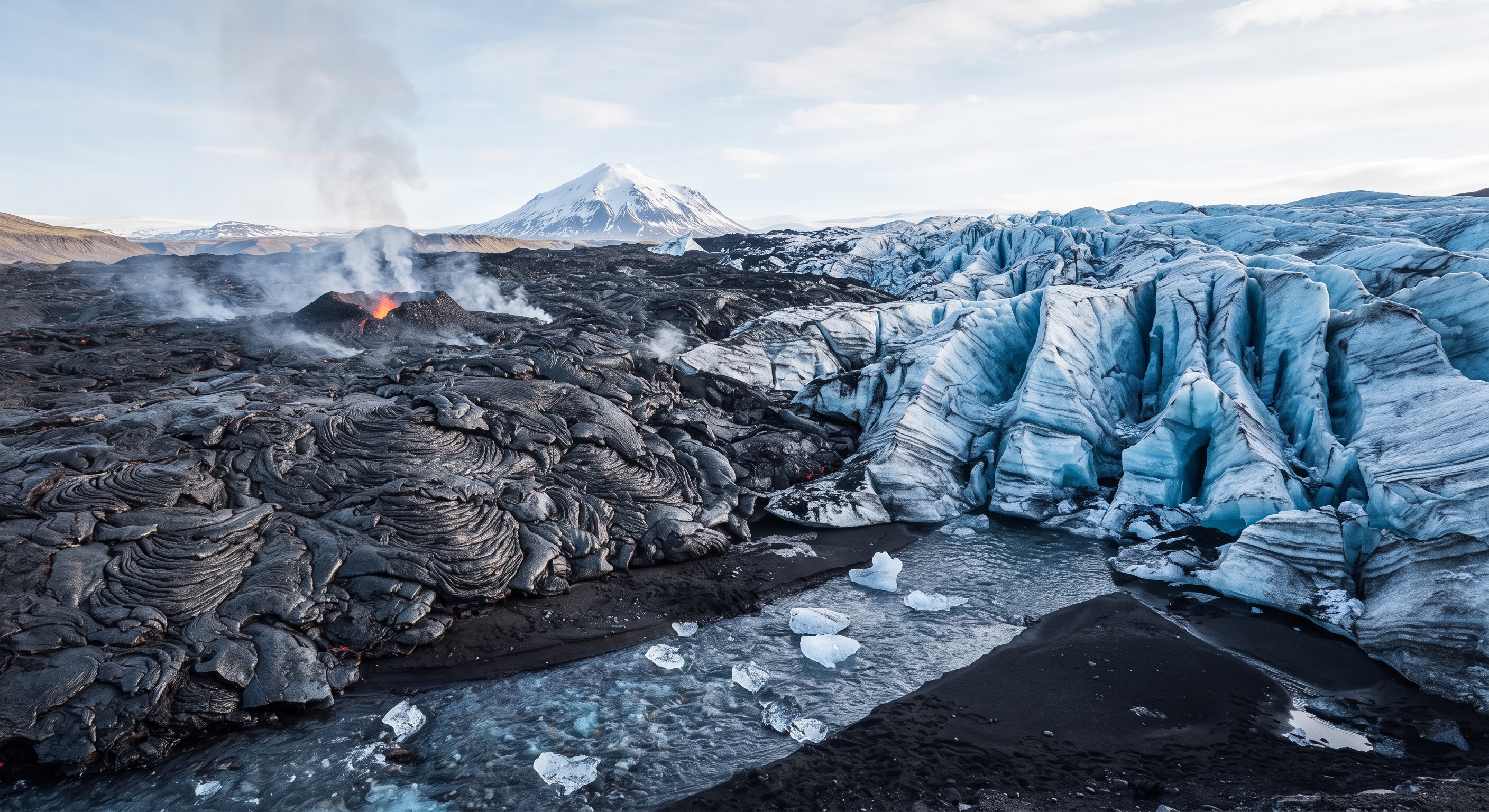
Iceland is a land of extreme contrasts, where raw volcanic fire and ancient glacial ice coexist in dramatic harmony. Situated directly on the Mid-Atlantic Ridge, this remote island is a hotspot for intense tectonic activity. Massive tectonic plates pull apart day by day, allowing molten magma to rise from deep within the Earth and creating a dynamic, ever-evolving landscape.
Where Tectonic Plates Meet
The island’s unique geological position makes it a living laboratory for earth science. As the Eurasian and North American tectonic plates drift apart by about two centimeters each year, the landmass constantly expands. This tectonic pulling creates vast, rugged lava fields and towering volcanic peaks across the horizon.
Unlike many other regions, this activity is completely visible above sea level. In places like Þingvellir National Park, you can walk right through the rift valley, witnessing the literal gap where two continents are tearing away from each other.
The Battle of Geothermal Heat and Ancient Ice
Beneath the surface, intense geothermal energy boils groundwater, fueling powerful geysers that burst into the sky and bubbling mud pools that showcase the heat radiating from below.
Yet, right beside these fiery forces lie some of the largest glaciers in all of Europe. Ancient ice caps cover over ten percent of the country, carving deep valleys and dramatic fjords. As these glaciers melt, they feed hundreds of majestic waterfalls that thunder over rugged, basalt-columned cliffs.
Fascinating Hidden Facts About Iceland’s Geography
- Walking Between Continents: You can actually snorkel between the North American and Eurasian tectonic plates in the crystal-clear, freezing waters of the Silfra fissure.
- The Youngest Deep Lake: Iceland’s deepest lake, Jökulsárlón, plunges 284 meters deep and only began forming in 1948 as a result of rapidly retreating glacial ice.
- Geothermal Ovens: In certain geothermal areas like Hveragerði, locals take advantage of the boiling ground to bake traditional dense rye bread (hverabrauð) by burying dough right in the soil.
- A Mosquito-Free Habitat: Despite having countless damp wetlands and ponds, Iceland is completely devoid of mosquitoes due to its unique climate fluctuations and wetland chemistry.
A Testament to Planet Earth
From black sand beaches to glowing blue ice caves and steaming caldera lakes, Iceland’s raw power is always on display. The interaction between hot magma and cold ice produces otherworldly landscapes found nowhere else on Earth. It remains a breathtaking testament to the volatile, beautiful forces that continue to shape our world.
What are your thoughts on Iceland’s extreme geography? Let us know in the comments below, and explore more wonders over at Kinfinity World!
Here is the bibliography and reference list for the content generated for your video, blog post, and geographical facts about Iceland:
Bibliography & References
- Geological Formation & Tectonics
- The Mid-Atlantic Ridge and Plate Tectonics in Iceland. Iceland Geological Survey / Jarðvísindastofnun Háskólans. Overview of the divergent boundary between the North American and Eurasian plates, contributing to the island’s expansion rate of approximately two centimeters per year.
- Þingvellir National Park Management Plan. UNESCO World Heritage Centre. Documentation on the geological significance of the Almannagjá gorge and the visible tectonic rift valley.
- Glacial and Geothermal Features
- Glaciers of Iceland: Vatnajökull and Surrounding Ice Caps. Glaciological Society of Iceland. Data concerning the coverage of ice caps across roughly ten percent of the country and their impact on fjord and valley formation.
- Geothermal Energy and Volcanic Systems in Iceland. National Energy Authority of Iceland (Orkustofnun). References detailing geyser mechanics, geothermal boiling pools, and sub-surface magma interactions.
- Specific Geographical Landmarks & Quirks
- Jökulsárlón Glacier Lagoon Depth and Evolution. Icelandic Meteorological Office. Historical data on the formation and depth (reaching 284 meters) of Iceland’s deepest lake beginning in the mid-20th century.
- The Silfra Fissure Hydrogeology. Thingvellir National Park Commission. Scientific records on the glacial filtration and water clarity between the tectonic plates.
- Ecology of Iceland: The Absence of Mosquitoes. Institute of Natural History, Iceland. Entomological studies explaining how climate variability and wetland composition prevent mosquito survival.

Leave a Reply